Your measured surveys are taking too long aren’t they? You want surveys complete in the time it takes to drink that cup of tea the client has made – lucky you! that’ll take the edge off the monotony – and you want to head back to HQ safe in the knowledge that you’ve (definitely) not missed any crucial dimensions which would otherwise come back to haunt you. Well, unless you’ve got one of these and a small mortgage to go with it, no doubt like me you’re trying to speed up this process and/or have less of a headache after…
Preface
Starting 2020 my iPad bit the dust – it’s been one of those years hasn’t it? – and being a heavy desktop user, the iPad fills the only remaining holes at my workstation: mobile work not requiring heavy lifting & sketched content creation (Apple Pencil/Stylus), both of which I’m of the opinion that the iPad does better and in most cases, more cheaply than a laptop, but hark! this is a discussion for another time. Glory be to the warranty gods then, that I was covered for the ‘conked out’ iPad and shortly afterwards the iPad Pro 2020 joined the fray. What peaked my interest over the existing models was the new Lidar sensor as part of the camera array which promised 3D scanning; improvements to AR & photography etc. All things which ourselves at MAVRiC are very much “down for”.
This brings us to today’s post because after many months in anticipation of new ‘Lidar-enabled’ apps, the one app we were eagerly expecting to have this feature was MagicPlan. So is this the ‘magic’ solution to your surveying requirements? Let’s find out…
LiDAR
Firstly, a quick background on Lidar and Apple’s own implementation of it:
- Originally the word was a combination of ‘light’ and ‘radar’, now it’s used as an acronym of “light detection and ranging”.
- Greater awareness for Lidar and its uses came during the 1971 Apollo 15 mission when, using a laser altimeter, astronauts mapped the surface of the moon – and you thought surveying a property was too much.
- Lidar uses pulsed lasers to measure distances, when combined with other data it can create accurate 3D information, similar to point cloud scanning with expensive lasers (yes, like the one linked above).
- According to Apple, their lidar sensor measures objects up to 5m in distance, compare this with time of flight (ToF) which measures up to 2m.
- One downside to lidar is a difficulty in detecting glass walls or doors; this issue can be mitigated with other secondary sensors/cameras.
How Does MagicPlan Work?
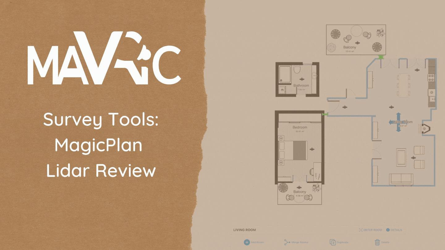
MagicPlan is available for free on both Android & iOS, on smartphones and tablets (I’d recommend the latter for screen real-estate), it offers several nifty features presented in AR to help you with surveys. Primarily of which is room scanning, which according to MagicPlan, uses your device’s camera to detect room walls and corners and window and door positions aided by artificial intelligence. There are other features such as floor allocation, object placement, stitching rooms together, export features etc. but for brevity’s sake and you, our dear blog lurkers, we’re not going down that rabbit hole.
So, now that lidar support has come along there are two methods by which to scan walls and plot out your floor plan and you can switch between these modes as you take measurements, it’s up to the user to distinguish which mode works best based on your surroundings, these are:
Corner Mode: As above, simply move the camera around, begin by setting the ceiling height, then the app will detect and automatically pick up on the corners of the room. Corner mode works well with complex angled rooms.

Auto Mode (LiDAR): Here, you hover over a wall in the user interface and the lidar sensors will engage to start scanning each wall, one at a time. LiDAR seems to work well in situations where you can’t access the corners, but you can see the wall surface (most rooms in houses!).

Variables

In order to judge MagicPlan’s effectiveness as a survey tool we first need some comparison. As such, I’ve tested the following options:
- Pen & Paper with laser disto.
- MagicPlan Corner Mode
- MagicPlan LiDAR Mode
- Combination: MagicPlan with laser disto.
Now is a good time to mention that the laser distance measure (disto) used was a Leica bluetooth disto, other brands are available, but bluetooth is important as this means MagicPlan can receive measurements and alter existing ones, which it does VERY well.
As you’ll see, I’ve trialed each option once in a small room (2 x 2.5m) & once in a larger room (7 x 3m) to see if the greater complexity affects results. In analysis, each measurement (i.e. the same location, opening or wall) in LiDAR & Corner Mode is compared against the baseline of the disto measurements (in this case, considered baseline as it is ‘accurate’. These variations from baseline are then totalled up to give an average figure for accuracy.

Limitations
The limitation to this brief study is that it doesn’t address any large discrepancies between data I.e. anomalous readings where the data is significantly different to standard disto readings due to issues with hardware (LiDAR or A.I) or survey environment. Several iterations of the same trial might help here, but we’ll have to make do with limited time!
The 3 Factors
(For the uninitiated) When it comes to carrying out measured surveys there are three factors which are going to make things easy or difficult for you. These factors we’ll address to analyse the options above. Let’s begin.
1. Accuracy
Our first stop is accuracy. It doesn’t matter how long it takes you, if the accuracy is poor a false dimension can cost you dearly either in time, embarrassment or even in liability. So, let’s take a look at how each option fared .
*Note: MagicPlan + disto combination has been left out here, where measurements will equal paper + disto measurements. According to Leica, this is within (+/-) 1mm over 10m.

As the graphic shows LiDAR was accurate to within 50mm on average in a simple small room where readings were easier to take, Corner mode less so with readings out by 100mm on average. Compare this to more complex rooms where LiDAR struggled more, accuracy on average was 170mm out.
What this means then, is that you can’t rely on device measurements (in this case MagicPlan’s measurements) if you want accurate information. What’s the point then you ask? Well, as we’ll see next there is a benefit to using MagicPlan’s AR tools and the accuracy issue can be addressed…
2. Time/Duration
Second, we have the time taken to carry out the survey.

As is apparent from the graph, it’s considerably quicker to create a floor plan using MagicPlan’s Corner and/or LiDAR Mode compared with good old fashioned sketching. Here’s where it gets interesting, if you go the combination route and use a bluetooth disto, your time to completion is still much shorter than sketching and you’ll have the benefit of very accurate plans, win-win!
3. Third Factor
If you weren’t sold on the above figures, here’s where such apps like MagicPlan really make the difference. So, what’s the final factor you ask?…
It’s BIM. The real upside here is not so much the time saved on site, but rather the time saved afterwards. The ability to export information to CAD & 3D programs potentially saves hours of redrawing ‘as built’ information and that’s not to speak of other ‘BIM-like’ features like component metadata and documentation generation. Ok, it may not fit the highest ideals of BIM but I’ll take it!


Summary & Thoughts
To summarise then, the accuracy of the new LiDAR is a bit of a disappointment and it seems that unfortunately you’re going to have to keep remembering to bring those AA batteries for the disto every time you put on your surveying boots. It does show however that you can achieve good results relatively cheaply if you can pick up a smart device (who hasn’t got one?), a bluetooth disto can be picked up for under £100 and evidently, LiDAR sensors aren’t essential.
Having said that, LiDAR does seem to speed things up in certain scenarios and it is absolutely a welcome addition to the app; it will be interesting to see how/if MagicPlan can push the software further to improve their readings or functionality.
Other than improved LiDAR functionality, another nice feature would be support for ultrawide camera lenses; it would make things a lot easier to control! Additionally, it seems that window/door detection doesn’t always work that well, on the odd occasion doors show up as windows and visa versa or the wrong type of door or window is shown. It takes just a second to correct this manually, but perhaps this is something MagicPlan can resolve in their A.I?
📢 To the folks at MagicPlan if you are reading this 👋🙏
There we have it, do you have any surveying tips you can recommend? Are there any competitor apps you prefer? How many measured survey horror stories do you have to share?
We’d love to know, please leave a comment below and thanks for reading!

One thought on “MagicPlan: Now with added LiDAR 🧂”